The Luppitt Tithemap

Choose one of the optoins below to view photos of the 1842 tithemap:
- A TEXT BASED menu, used to select photos of the Tithe Map. Use this link if you know the name of the place you are looking for, but are not sure where it is in the parish.
- A MAP of Luppitt Parish, used to select photos of the Tithe Map. Use this link if you want to look at photos from a particular area of the parish, or are not sure of the name of the place you would like to see. The images are approximately 1500 x 900 pixels and approx 300KB in size.
- A WORD DOC, or TEXT FILE copy of the Luppitt Tithe Map apportionment list of 1842. The apportionment is a record of all the field numbers printed on the tithemap, with a cross-reference to the farm they were part of, as well as information on field size and land-use at the time (e.g. pasture, arable, etc).
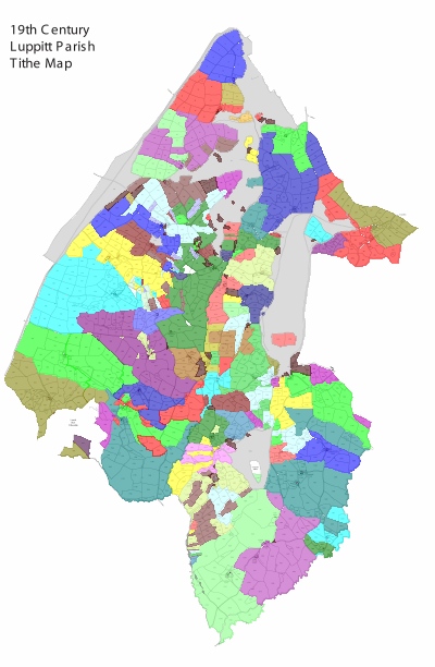
Using the apportionment it is possible to determine the extent of each farm in the Parish at that time the tithemap was compiled. The images below use this information to show a representation of the farms and land-use in Luppitt in 1842, as well as from a later survey in 1986.
|
|
As part of a palaeoenvironmental research project on the Blackdown Hills, Exeter University created a line a line drawing copy of the Luppitt tithemap. A scaled down copy is shown to the left, and the original can be reached via the Community Landscapes project website at Exeter University. Each field shown on the tithemap has now been overlaid with a colour based on which farm it was part of in 1842. See below for more details. |
|
|
From the the base image above, a vector image has been overlaid on each field, so that field related information can be easily and quickly updated in future.
Download larger versions of this image by clicking on the links below: |
|
|
The scaled down image to the left shows the distribution of farms in Luppitt in 1986 when a local history exhibition was held. Local landowners entered the details of the fields they owned into a new register provided at the exhibition. Note that where a colour is present in two quite different areas of the map it represents two different farms. If you know who owned any of the blank fields in 1986, please get in touch so that the map can be updated. Download larger versions of this image by clicking on the links below: |
|
|
On this image the colour of the vector image for each field has been changed, so that the colour indicates the land use type from the Apportionment list. Download larger versions of this image by clicking on the links below: Key:
|
These images are © the Luppitt History Group, please do not reproduce them without acknowledgment.


